

Nature
Hachimantai in Iwate Prefecture is an area located in the Ou Mountains (39-40°N, 140-141°E), with a series of peaks at an altitude of 1,300-1,600m. The river system here joins with the streams and rivers flowing from the Kitakami Mountains to form the Kitakami River. This river flows south through central Iwate and flows out into the Pacific Ocean at Ishinomaki. The Kitakami River is the fifth longest in Japan and the largest in Tohoku with a total length of 249km.
As a highland region, Hachimantai’s has a cool climate with a yearly average temperature of 6℃. The severe winter between the end of December and early March often records temperatures lower than -15℃. The snow storms during this time are intense, with wind gusts of over 20m/s occurring daily and severe blizzards with winds of more than 30m/s are not uncommon. In a normal year, the treatment facility records over 2m of snow.
Annual precipitation in recent years has been around 2,000mm with July-September being the highest and January-March the lowest.
Hachimantai is one of the richest natural settings in Japan with great views, and it spreads out by the former Matsuo Mine. Hachimantai is a vast highland area within the Towada-Hachimantai National Park, and with the peak of Hachimantai (1,613m) in the center of Mt. Morobi, Mt. Ofuka, Mt. Chausu, and other peaks. However, gas emitted from the sulfur refinement process devastated the plants around the mine, and there was a period where greenery was lost. However, it is coming back thanks to cleanup work after the closure of the mine. Trees are also starting to grow thanks to tree-planting work done by volunteers.
Dotted around Hachimantai are wetlands and crater lakes, where alpine plants and animals can be found. It’s a place where visitors can experience the different seasonal landscapes: flowers from spring to summer, the colors of the autumn leaves, and the expanses of frost-coated trees of winter.
Hachimantai is a shield volcano located on the northern border of Akita and Iwate Prefectures. Hachimantai is classified as a belt of 3 volcanoes with Hachimantai volcano (altitude 1,613m) at the center, Mt. Ofuka volcano (altitude 1,541m) connected to the south and Mt. Chausu volcano (altitude 1,578m) connected to the east.
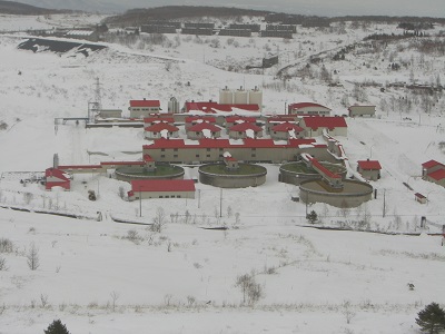
Matsuo Mine is located close to the southern base of Mt. Chausu and the ground is made up from pyroxene-andesite, olivine pyroxene-andesite, and small amounts of dacite from lava flows and clastic rocks. Northwest of the central area of mountains and forests is a remarkable deterioration zone which contains sulfide ores as well as hot springs and hot geothermal areas spread widely in the surrounding areas.
このページに関するお問い合わせ
Mining and Water Resources Section (Mining), Environmental Preservation Division,
Department of Environment and Residential Life
(020-8570) 10-1 Uchimaru, Morioka, Iwate, JAPAN
TEL:019-629-5358 FAX:019-629-5364