

2) The Position of the ILC Tunnel
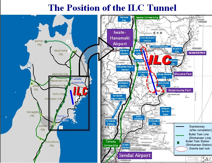
Take a look at the map on the left. The blue line is the ILC tunnel, and the green lines are the Shinkansen bullet train lines. Black lines represent automobile expressways.
The map on the right is zoomed-in even further. The red dotted line shows areas with granite bedrock underground, which is ideal for the tunnel’s construction. According to Tohoku University in Sendai, the bedrock in this area is extremely stable ? even microvibrations are very rare, and there are no active faults. The National Astronomical Observatory of Japan Esashi Earth Tides Station monitors the bedrock, and there was absolutely no damage detected when the 2011 earthquake hit. This is why the area has been evaluated to be ideally suited as an ILC site.
Shinkansen bullet trains, expressways, and an airport are readily accessible, and travel to and from the Tokyo area is easy and convenient. Furthermore, to the north and south lie the urban centers of Morioka and Sendai, and there is a mid-sized city right next door. All of these factors will contribute to a comfortable, modern lifestyle.
このページに関するお問い合わせ
ILC推進局 事業推進課
〒020-8570 岩手県盛岡市内丸10-1
電話番号:019-629-5203 ファクス番号:019-629-5339
お問い合わせは専用フォームをご利用ください。